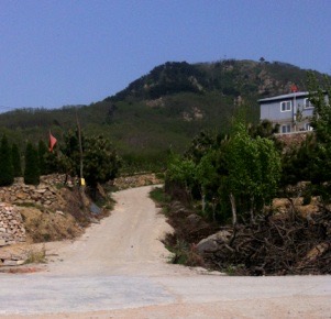
Qingdao is an exciting city to live in if you like the hills. I have not found another city with hills so immediately accessible, not even in Britain. <Many images, slow to load>
My pal Sean & I (Yellow Submarine and 2FF) suggested to each other that it might be possible to cover FuShan, JinJiaLing and WuShan in the same day, about 35km. We added BeiLing since it sits between the second and third. For some people JJL ends with XiShan, so we could (and have) called this 'the five peaks of Qingdao'. We did the route in October of 2013 and the hash enthusiastically adopted the idea as a relay hash for late October or early November – which may not happen now that 2FF is ejected from Qingdao thanks to the five year rule (essay 132).
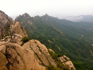
Fushan is the spectacular long ridge running from the centre of town out to LaoShan. At your first visit it takes maybe five hours to do the ridge, partly because you will go explore as much as you can and you have no idea which of the many paths goes quite where.
On the right here is the first real peak of FuShan, taken from the ‘top of the steps’ - which run from two directions to this point. Relevant to a ridge route is the ascent from Dan’r Er Lu past the spring and always heading upwards to the ridge. On the left here is the attractive pair of peaks as seen from the north side - I think the best view is from the east, Laoshan, and the very brown picture is of the same peaks from the seaward side. Between the first peak and this pair are several other peaks to clamber over, such as the one C is grinning at.
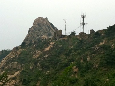
This picture down to the right with comms towers is adjacent to the twinned peaks, with a small dwelling housing an old couple and a dog. Just occasionally they’ll sell a beer to visitors. Many paths reach the ridge route from both sides. As I have said before, the problem with hills in China is not the route on the mountain, but the route to the mountain – the fence-crossing points are hard to find. In general, what one does is find a way on by asking or following and then discover a route off – and use that later as a route on. The twin peaks are climbable but very slow going; to do all three ridges in the same day you would leave these out.
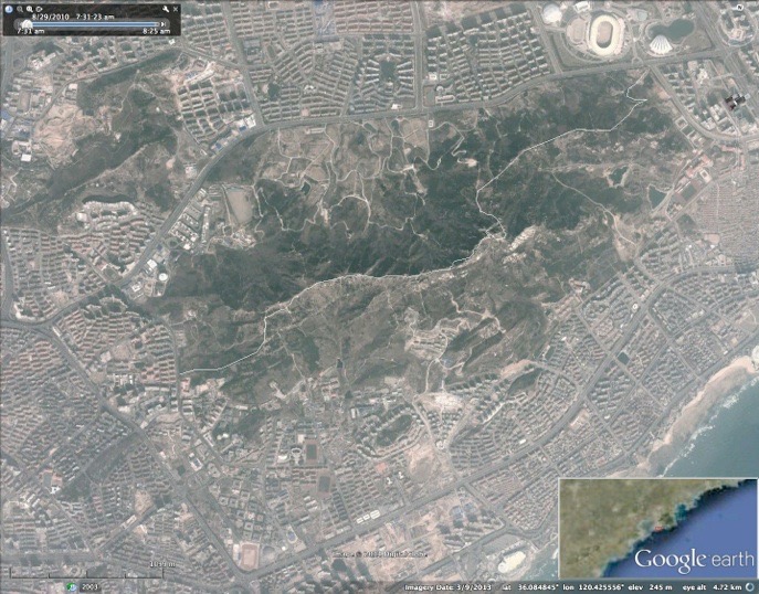
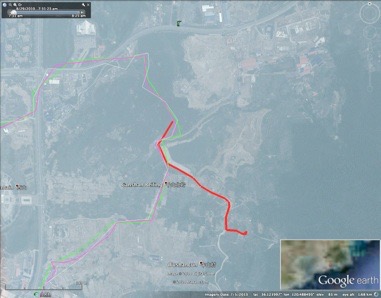
Here is a Google map image of the ridge route.
The ridge shown here is what is left of FuShan after the twin peaks and still going to the east. When you reach the last clear point turn left (north) and aim to join the car-width track running from there towards the stadium on YinChuan Lu. Cross Hai’er Lu and Shenzhen Lu and turn (left) uphill on Yanling Lu.
JinJiaLing [JJL] is the boring-looking ridge that the city is steadily eating that sits on the north side of LaoShan, between YinChuan Lu, Tong’an Lu, LiaoYang Dong Lu and SongLing Lu [SLL]. This collection of hills runs across to SongLing Lu round the back of the several universities and it is more complicated terrain than one would expect. The west end is JinJiaLing, being eroded by construction nearest DangXiao party school, and the east end is called XiShan (west peak?) with a market garden under netting lying in the gap between the two. Xishan is being eaten away to the north and south by QUST, who built residential blocks on LiaoYang DongLu but so far have connected them only within the site grounds. Our route crosses this new road (a small kiosk sells drink) to SLL.
This image below for JJL shows a hash route over the middle two peaks. The access is from the top of the hill of YanLing Lu, where a concrete road forks off (and upwards) round the end of the running track that sits on top of the row of shops (yes, it does). Do not turn left into what looks like a fire station (labelled on my best map as the high-tech blasting company) but almost straight onto the mountain. The first southward V in the route is sharply down and up and it is the peak above the university residential area that is called JJL, though by then that feels like the third or even fourth peak. A descent towards this lets you skirt the upper edge of the burial slopes and gives the swiftest access past the market garden netted area, hence to Xishan. People find all of this route hard to follow. Xi Shan itself has a fine rock face to go straight up and then you can see the steady descent to which SongLing Lu ends with an unreliable (changeable) crossing of a road inside the university grounds and my preferred route comes out as shown on SongLingLu just south of the gas station. I suspect that in time we will be forced to follow the QUST road through the main gate and go back north on SLL, in which case I also expect majority opinion to eliminate BeiLing altogether and cross SLL almost directly (a shade south), working through the new estate (not complete in 2014) up to the ChaiChang reservoir.
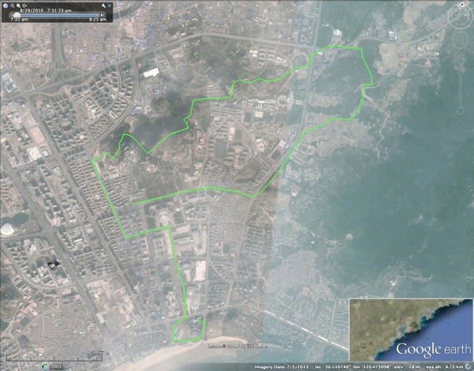
The route above then shows the route over Wushan BeiLing and the visible G scar where the green line kinks on the right is the road around the reservoir’s west end. That road is the one to take to reach the ridge of Wushan, the dark mass lower right. You would think there is a route running further to the northeast, but I have not found a way through. Damned dogs doing their duty.
BeiLingShan is the little peak at the northern end of Wushan, basically across SongLing Lu from the eastern end of JinJiaLing (XiShan) and a useful reference point is the reservoir to its south, marking the obvious preferred route to WuShan, whose ridge runs towards the sea and aims itself at the old man of Qingdao, the rocky pinnacle ShiLaoRen.
Access to BeiLing from the north is opposite the golf course entrance through what looks like a gateway, round a brick building and up to the left onto an immediate track - as ever, it is the fence crossing that is hard to find. Thereafter the route is rather nice and yet the whole thing is a harder walk or run than you would first expect. On the top there are two principal routes off, one more to the west, but all choices should head to the road across the head of the reservoir called Chaichang.
This image shows the route from BeiLing to WuShan in a broad red.
Once onto WuShan the first ridge (with two small comms towers) heads to a rocky tor with fine views and a popular descent to No2 school. The onward route returns north by 100m and turns NE and E before going more southwards. A significant saddle gives a route off to the right (to MiaoLing Lu) and the next peak and ridge is notable for the ‘rocket’, a rather more unusual comms tower (I assume). Going down from here is a good route for hashing but it is not quick. Ideally to reach ShiLaoRen one would continue south over the last rocky peak (perhaps called Shiwan or Dala) and through the gateway that leads down past the zoo (you may be charged an entry fee) which drops one on the coast road and thus offers finish at the sea. Personally I’d prefer to descend to MiaoLing Lu, but your choices depend upon the challenge articulated before starting.
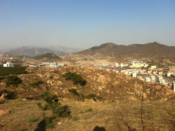
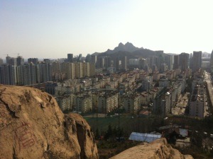
This is a view of Wushan and BeiLing from Jin Jia Ling. THe big yellow building is No2 Middle School
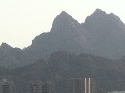
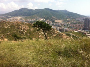
This picture shows the whole of WuShan.
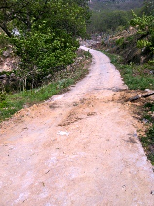
This is the difficult-to-find point of entry onto WuShan at the north-western corner. nearest to the reservoir.
When Sean & I did this (just the once) we went up onto Fushan from MaiDao (spelling?) on the university side and that set of steps and were off Fushan at 1.25 hours. At three hours we were over JJL and BeiLing and on the ridge of WuShan. At 3.25 hours we were both struck by a lack of sugar, salt, food and fluid and hit with cramp and similar issues, meaning we returned to our start point at 5.5 hours, a little ashamed at the collapse. If doing it again we’d be looking to go slower on the uphill, to carry more food and to combat sweat (salt) loss effectively. In a sense we went too quickly over FuShan; aiming to be off at 90 minutes would be better planning.
Sean did the whole thing, including his original plan of revisiting FuShan, in six and a half hours, October 2014. Open challenge.
The challenge ‘the Peaks of Qingdao’ is (badly) expressed like this; do the length of the three big ridges. Do all four hills. Go over or past all the peaks. Ideally the hash would lay trail on a particular day for individuals and teams to cover the distance. It is a big challenge for an individual, who needs support at the start of each ‘next’ hill. I would recommend using teams of 2-4, with changeovers between peaks. I think the target should be to get people to finish in the same 60-100 minute interval and I wonder where best to start and stop. It would be clever sales to start at the Crowne Plaza and finish at the Hyatt, but that is more like 40km and five hours would be extremely good, even for a team. If I was raising a team I’d want to have a road runner for the two ends and the bit between FuShan and JJL. A good hill runner might do Fu and Wu. Good sales would be to insist that every team is mixed. Good support would have food and drink on hand — and the route would be laid by a team that knows what it is doing — or, the hash puts discreet signs out in a more permanent way, introducing that sort of signage to China. I’d suggest what I think of as the Orienteering mark.
DJS 20140610
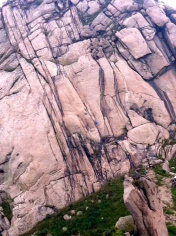
There is a little blue dot just below the centre, going downwards. I watched this guy do the whole descent in under a minute in a sort of controlled fall. This is the west face of the eastern of the twinned peaks of FuShan, dropping to what I would call the saddle.
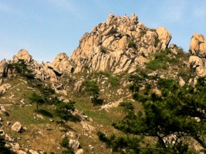
I have found a route (the route, since I didn’t create it) round the base of this tor - both sides. It would make quite a good hash route, up round the rock and down again. Both parts close to the rock have parts that walkers would call extreme. Let’s just say your hands are needed (but not a rope) – and not all that much, just enough to be exciting.
All the pictures are mine. I apologise for the lack of completeness, but then I was not expecting really to be leaving, for all the noise I made at work. A very Chinese disconnect between home and work occurred.
2FF is the short form of the hash name Two Fucking Fast.
2FF = 300H-1. In polite Chinese, Shen Su.
I had such problems with up-loading to the site in 2014 that, at the time of managing to publish, Sean had just written last week (early October) to say he has done the lot, including the repeat of FuShan, in 6 1/2 hours. And this page has yet to be read by others.. DJS 20141009
